PV Potential Analyses and Feasibility Studies

At Fraunhofer ISE, we carry out studies on the potential of integrated photovoltaics and ground-mounted PV systems at local, regional and national level. Our aim is to provide comprehensive insights into the possibilities and opportunities of PV utilization and thus support decision-making when installing photovoltaic systems.


Calculating Area Potential


The solar energy potential is calculated using geographical information systems (GIS). Factors such as solar radiation, available areas, infrastructural conditions or legal framework conditions are collected using multi-criteria decision analyses and analyzed in the GIS in order to evaluate the potential for installation. Precise year-round irradiation analyses are used to precisely calculate the solar irradiation and shading caused by buildings or vegetation, which are then included in the potential analysis. For each suitable area, both the potential electricity yield and the possible installed output in kilowatts are calculated. 

Overall PV Concepts

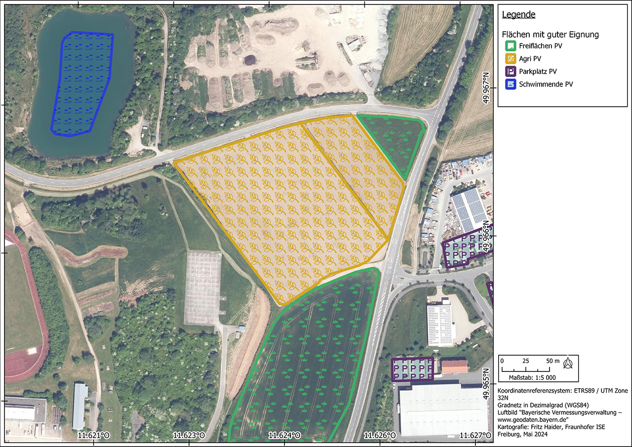
Flächenpotenziale unterschiedlicher PV-Anwendungen
© Fraunhofer ISE
Analyse von Flächenpotenzialen für unterschiedliche PV-Anwendungen.

Our approach is to develop a comprehensive overall concept for municipalities and cities that takes into account the potential of both ground-mounted systems and integrated PV technology. By applying multi-criteria analysis, different boundary conditions can be objectively recorded and included in the decision-making process. We consider not only the technical aspects, but also economic, financial and ecological factors. In this way, you can drive forward a sustainable and future-oriented energy transition in your community and exploit the full potential of solar energy.


Request potential analysis for overall PV concept

Ground-Mounted PV Systems

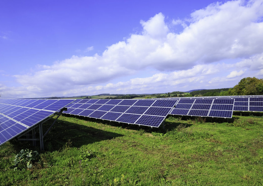
PV Power Plant
© iStock.com / Adam Smigielski
Freiflächen-PV-Anlage.
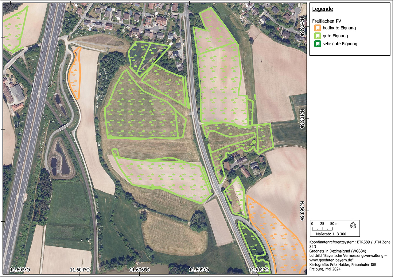
Eignungskarte für PV-Freiflächenanlagen
© Fraunhofer ISE
Eignungskarte für PV-Freiflächenanlagen, basierend auf dem digitalen Landschaftsmodell.

When searching for suitable areas for ground-mounted PV systems, various legal requirements, regional planning and the high pressure of land use must be taken into account. The "Digital Landscape Model" of the federal states provides an important basis for identifying and classifying potential open spaces. For decision-making purposes, the proximity to infrastructure and target areas is taken into account through the use of analytical hierarchy processes (AHP). This methodology enables a well-founded and systematic evaluation of the various locations and supports the selection of optimal areas for ground-mounted PV systems.


Request potential analysis for ground-mounted PV systems

Agrivoltaics

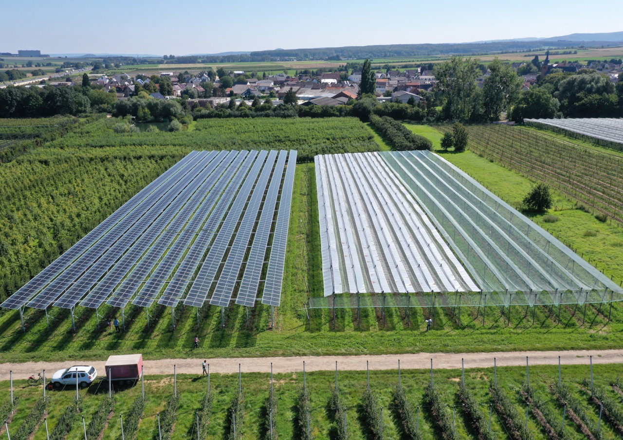
Agri-PV-Anlage über Apfelbäumen im Rheinland
© Fraunhofer ISE
Blick auf eine Agri-PV-Anlage über Apfelbäumen im Rheinland.
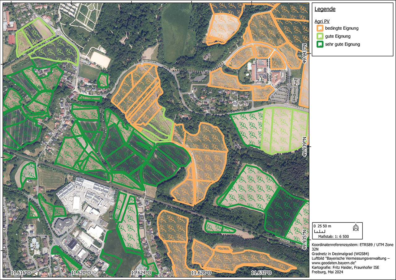
Eignungskarte für Agri-PV-Anlagen
© Fraunhofer ISE
Eignungskarte für Agri-PV-Anlagen, basierend auf dem digitalen Landschaftsmodell.

For agrivoltaics, it is possible to calculate the potential for various system designs at regional and supra-regional level. In addition to the recording and classification of marginal conditions of use, the agricultural areas are characterized and evaluated. This is followed by a site assessment based on various geographical, legal and technical criteria, as well as an area-specific, relative yield estimate.


Request potential analysis for agri-PV system

Floating PV

FPV-Anlage Leimersheim
© Fraunhofer ISE
FPV-Anlage mit einer Leistung von 1,5 MWp in Leimersheim.
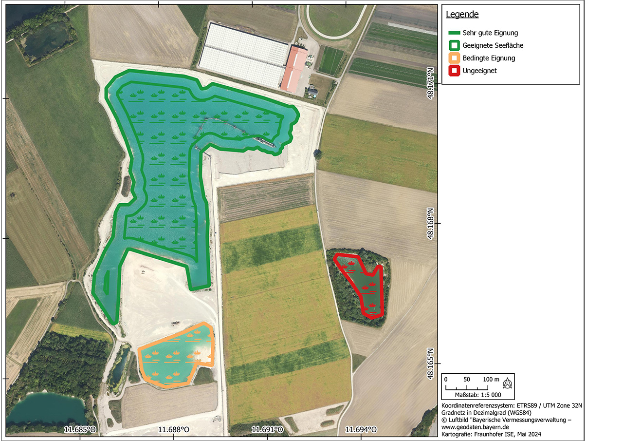
Eignungskarte für FPV-Anlagen
© Fraunhofer ISE
Beispiel für die Bestimmung des Potenzials für schwimmende PV, aufgeteilt nach Eignung der Fläche.

Floating photovoltaics (FPV) has seen impressive growth worldwide in recent years, with installed capacity of between 4.3 and 5.7 GW by the end of 2023. In Germany, there are sufficient suitable areas available on artificial lakes, in particular flooded open-cast mining areas, gravel pits and some reservoirs.

A potential analysis for floating photovoltaics begins with a GIS-supported suitability assessment of the area. This takes into account various criteria such as solar radiation, water types and local conditions. Potential mounting areas are then identified, taking into account local conditions such as water depth, water quality and environmental regulations. The results of this analysis provide information on the suitability of a site for floating PV, including potential yields, technical feasibility and legal framework conditions.


Request potential analysis for FPV systems

PV Along Traffic Routes

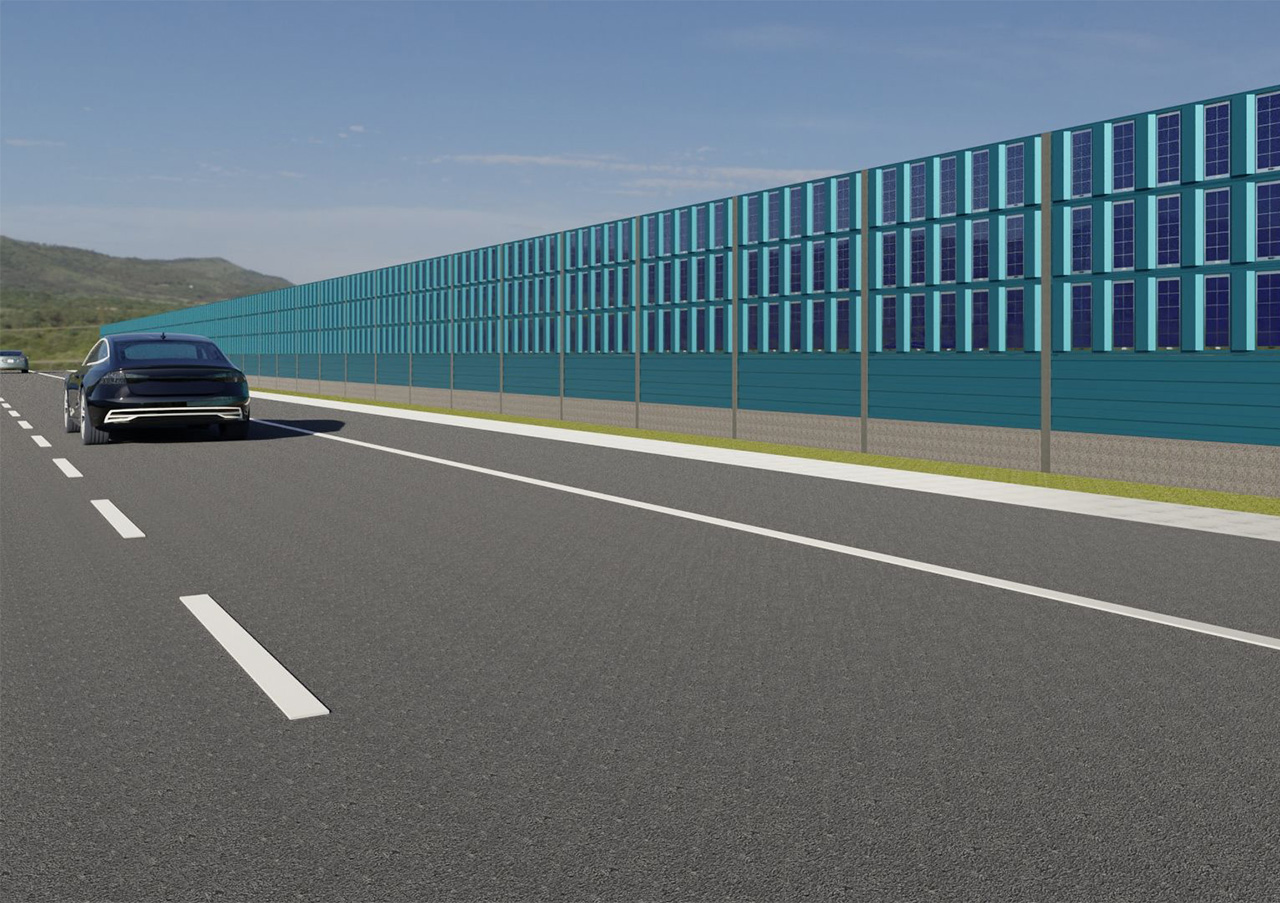
PV-Lärmschutzwand
© Fraunhofer ISE
PV, integriert in einer Lärmschutzwand
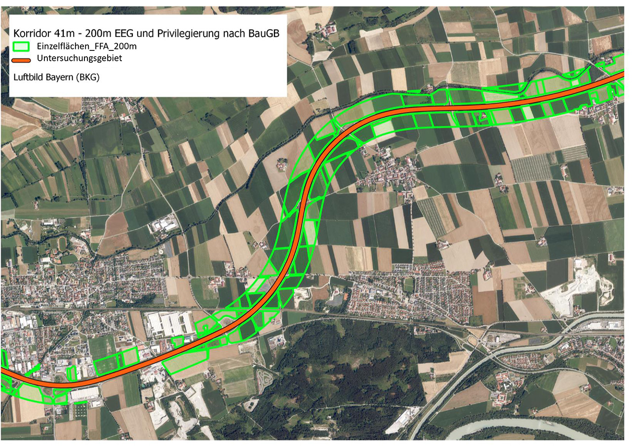
GIS-based analysis of the solar potential for noise barriers along an expressway.
© Fraunhofer ISE
GIS-based analysis of the solar potential for noise barriers along an expressway.

In Germany, there are a considerable number of noise barriers with a length of around 2,500 km and noise protection walls with a length of 1,300 km, which are ideally suited for the integration of photovoltaics. By using GIS tools in combination with yield simulations, high-resolution spatial yield forecasts can be created. Various aspects are taken into account, such as integration in new buildings or retrofitting in existing systems, as well as compliance with noise and glare protection requirements. This enables a well-founded assessment of the potential and profitability of such PV integrations.


Request a potential analysis for RIPV systems

Urban PV, Including Parking Lot Canopies

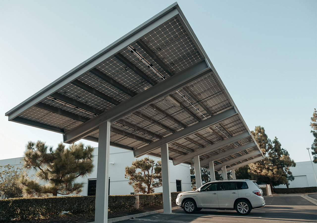
PV-Überdachung für PKW-Stellplätze
© pexels.com
PV-Überdachung für eine Reihe von PKW-Stellplätzen.
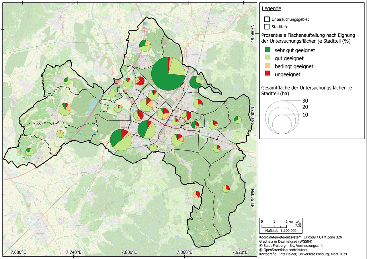
Eignung der Parkplatzflächen zur PV-Nutzung in Freiburg
© Fraunhofer ISE
Gesamtfläche und Eignung der Parkplatzflächen zur PV-Nutzung in Freiburg.

Urban photovoltaics (Urban PV) uses sealed surfaces in cities and municipalities to generate renewable electricity and make the locations visually appealing. Examples include large parking lots, public squares or sports facilities where photovoltaics are installed to provide shade, in combination with light, with charging infrastructure for electromobility or rain protection. This enhances the places for the user and makes the energy transition a positive experience. PV systems can serve as advertising signs on roads, integrate WiFi, 5G mobile communications or monitoring functions. Further advantages of this technology are the often short connection to the grid and the additional sun and weather protection provided by the roofs. The dual use avoids an additional burden on the environment and, if the systems are well designed, creates attractive and exciting squares and streetscapes.

Urban PV installations have to meet high demands in terms of design and functionality and therefore usually require individual solutions. Challenges of this technology can include higher shading effects from surrounding buildings or trees, special regulatory requirements, as well as higher static and building code requirements with regard to stability, mechanical load, noise absorption or the reflection effects of the systems.

To analyze the PV potential on parking lots, a data set of all relevant study areas is first created based on data collected by the authorities or freely available data such as the OpenStreetMap database. In a site suitability analysis, these areas are then checked for their suitability for the construction of parking lot photovoltaic systems according to criteria previously agreed with the client. These include factors such as shading, inclination, size of the area and distance to the nearest electricity grid feed-in point. Once the unsuitable areas have been excluded, the technical performance and energy potential is calculated, which can be carried out for entire parking lot roofs as well as for individual parking space roofs.


Request potential analysis for UPV systems

Building-Integrated PV

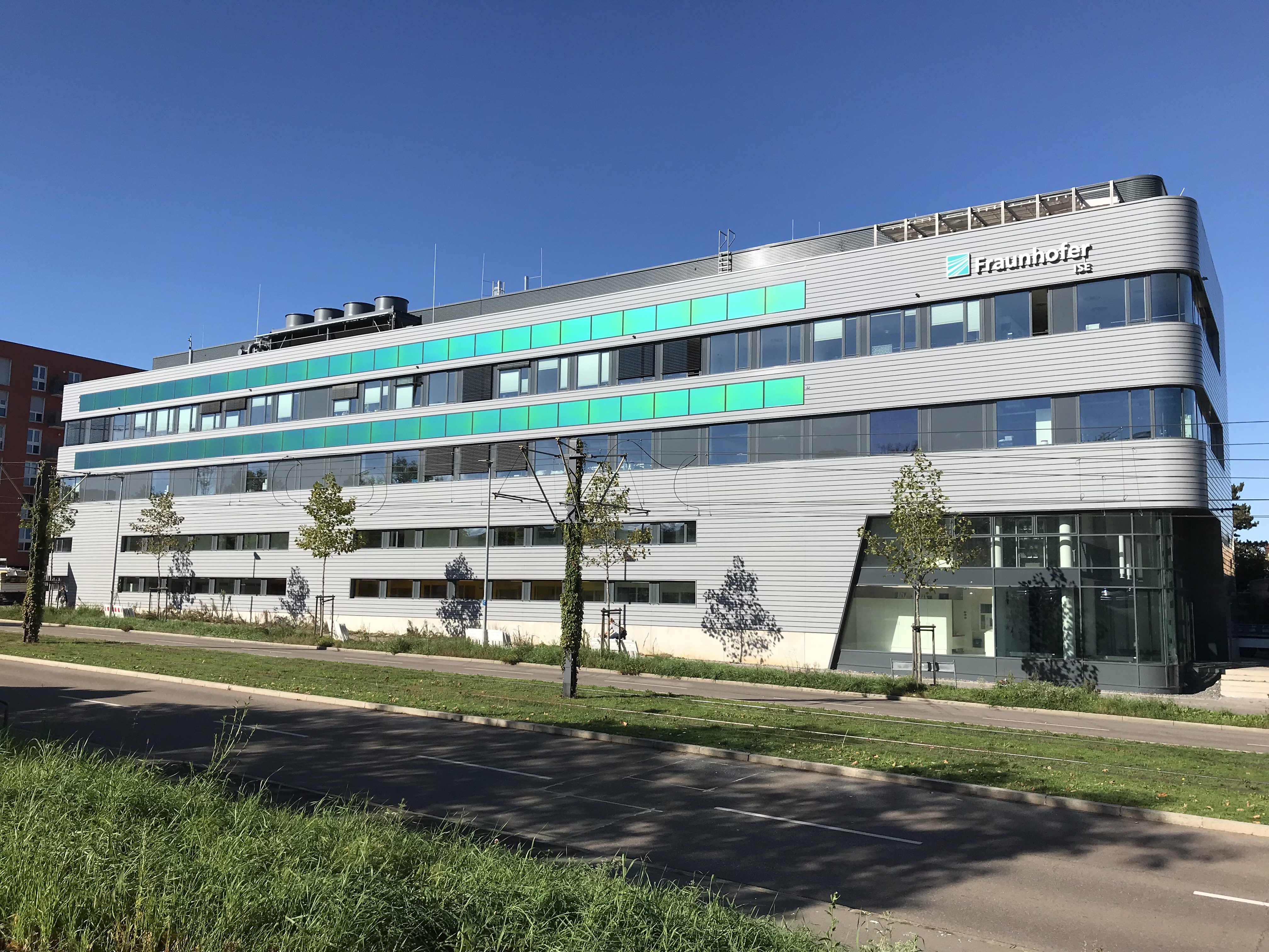
Center for High Efficiency Solar Cells
© Fraunhofer ISE
Center for High Efficiency Solar Cells at Fraunhofer ISE, Freiburg. MorphoColor® modules (green color stripes) in a ventilated façade.
Net-zero energy building - Freiburg City Hall in Stühlinger: Fraunhofer ISE considers almost all phases of a building's life cycle, from planning to construction and operation.
© Fraunhofer ISE
Net-zero energy building - Freiburg City Hall in Stühlinger: Fraunhofer ISE considers almost all phases of a building's life cycle, from planning to construction and operation.

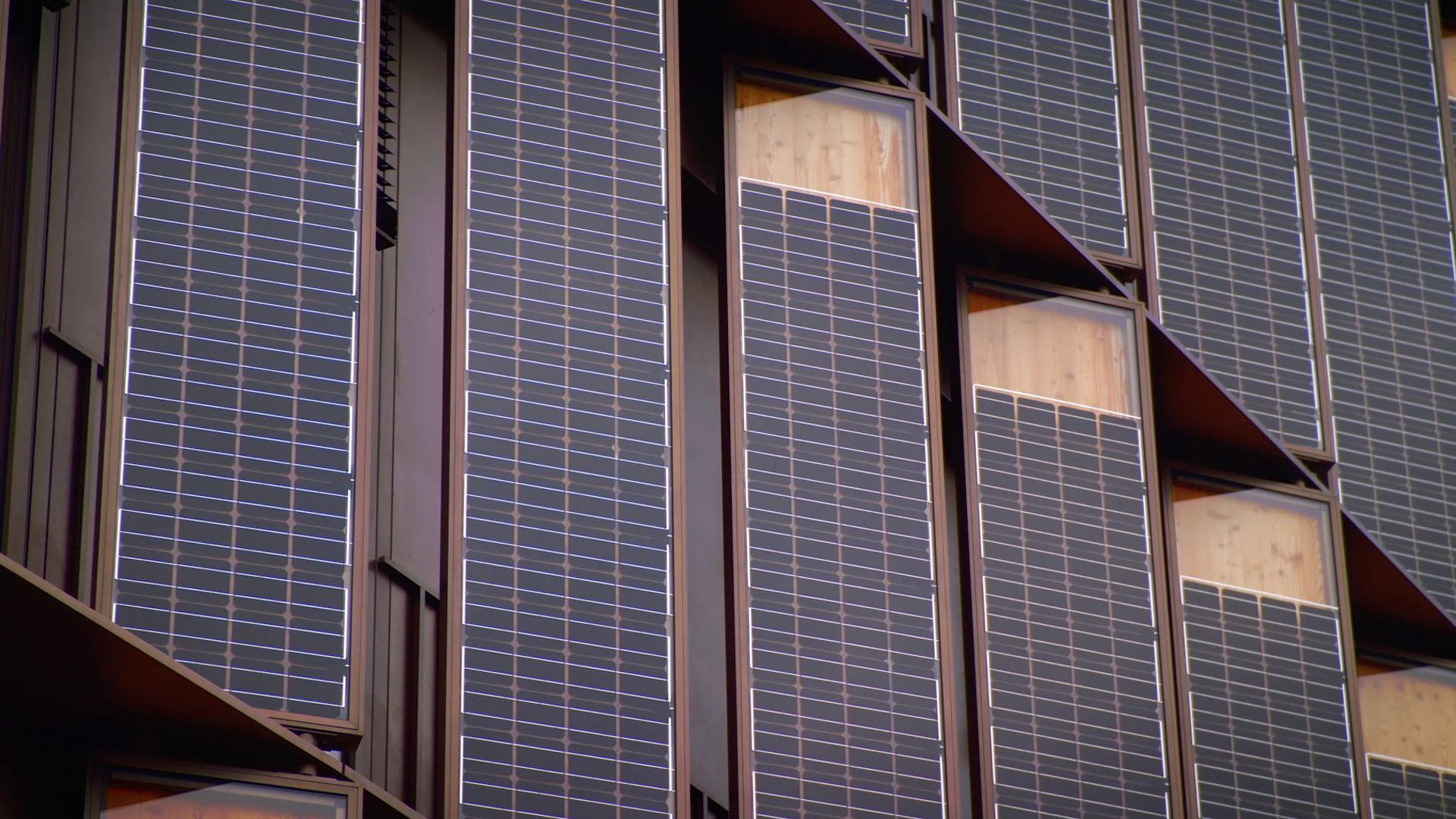
In an urban context, the integration of solar modules into the building envelope generally offers the greatest potential for the use of renewable energies. Large-scale potential analyses are also carried out on a building-specific basis.


Request potential analysis for BIPV system

Feasibility Studies

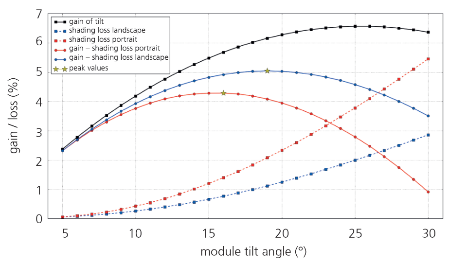
Analyse des optimalen PV-Anlagenertrags
© Fraunhofer ISE
Analyse des optimalen Anlagenertrags, hier mit verschiedenen Neigungswinkeln und Modulorientierung.

In a feasibility study, it is finally determined whether a PV power plant can be operated sensibly at the planned location. The results of various analyses of local conditions such as irradiation, location and environmental influences as well as the technical design of the PV power plant are taken into account. Another important component of the study is the techno-economic assessment.

The profitability of a PV power plant depends largely on the solar radiation at the location. We analyze the solar resources by using information from various renowned data providers. This data is compared with information from local sources such as weather services and, where available, ground measurements. The yield simulation is carried out using Zenit, a PV simulation tool developed at Fraunhofer ISE for this purpose. Zenit uses advanced algorithms and models to take into account various parameters such as the geographical location, the orientation and inclination of the modules, the efficiency of the solar modules and inverters as well as weather data such as solar radiation and temperature.

The environmental conditions on site have a decisive influence on the yield of the PV power plant over its service life. We use a geographic information system (GIS) to analyze the environmental factors. We use satellite data and continuous measurements at selected locations to record the corrosion and UV exposure of the modules, for example. This enables us to identify risk zones with a high dust load and forecast the expected risk of pollution. This information is crucial for calculating the maintenance costs of the system.

On this basis, well-founded decisions can be made to realize a successful and profitable PV power plant.


Request a feasibility study for a PV system

Contact

Karolina Baltins

Contact Press / Media

Dr. Karolina Baltins

Overall PV Concepts, Ground-Mounted PV Systems, Floating PV, PV on Traffic Routes, Urban PV

Fraunhofer ISE
Heidenhofstr. 2
79110 Freiburg

Phone +49 761 4588-5575

Salome Hauger

Contact Press / Media

Salome Hauger

Agrivoltaics

Fraunhofer ISE
Heidenhofstr. 2
79110 Freiburg

Phone +49 761 4588-5460

Jan-Bleicke Eggers

Contact Press / Media

Dr. Jan-Bleicke Eggers

Building Integrated PV

Fraunhofer ISE
Heidenhofstr. 2
79110 Freiburg

Phone +49 761 4588-2067

More Information on this Topic


Floating Photovoltaics

Analysis of the interaction between PV and water, technical optimization and quality assurance


Agri-Photovoltaik

Technical optimization and quality assurance of agrivoltaics systems for maximum electricity and harvest yields