Jahr
Year | Titel/Autor:in
Title/Author | Publikationstyp
Publication Type |
|---|
| 2023 |
Analysing Grid-Level Effects of Photovoltaic Self-Consumption Using a Stochastic Bottom-up Model of Prosumer Systems
Karalus, Steffen; Köpfer, Benedikt; Guthke, Philipp; Killinger, Sven; Lorenz, Elke |
Zeitschriftenaufsatz
Journal Article
|
| 2023 |
Benefits of pairing floating solar photovoltaics with hydropower reservoirs in Europe
Kakoulaki, Georgia; Gonzalez Sanchez , Rocio; Gracia Amillo, Ana Maria; Szabo, Sandor; Felice, Matteo de; Farinosi, Fabio; Felice, Luca de; Bisselink, Berny; Seliger, Roman; Kougias, Ioannis; Jaeger-Waldau, Arnulf |
Zeitschriftenaufsatz
Journal Article
|
| 2023 |
Photovoltaic Noise Barriers as Energy Generating Infrastructure: Functional Overview about Five Solutions
Forster, Jacob; Tsutskiridze, Giorgi; Kohlhauer, Reinhard; Huyeng, Jonas; Herr, Cornelius; Basler, Felix; Neuhaus, Dirk Holger; Heinrich, Martin; Rendler, Li Carlos |
Konferenzbeitrag
Conference Paper
|
| 2023 |
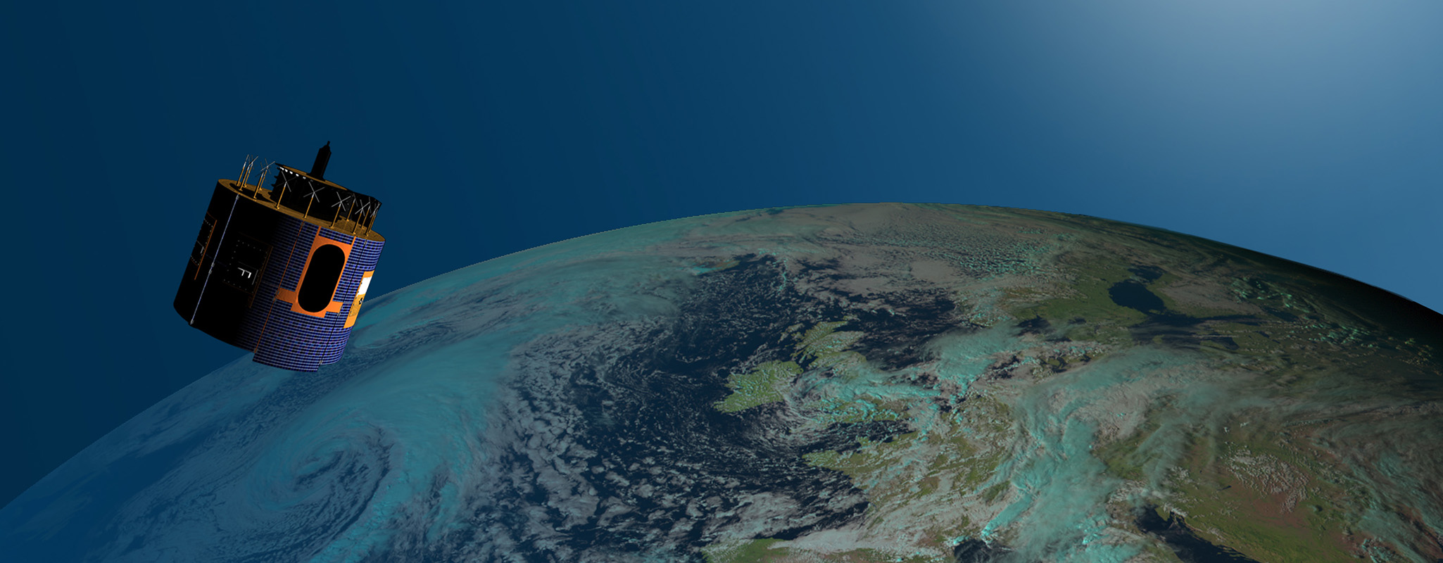
Independent Validation of SolarAnywhere Satellite-based Solar Irradiance Data
Karalus, Steffen |
Vortrag
Presentation
|
| 2023 |
Predictive Control of a Real Residential Heating System with Short-Term Solar Power Forecast
Villegas Mier, Oscar; Dittmann, Anna; Herzberg, Wiebke; Ruf, Holger; Lorenz, Elke; Schmidt, Michael; Gasper, Rainer |
Zeitschriftenaufsatz
Journal Article
|
| 2023 |
Representativeness of Energy Rating acc. to IEC 61853 for Different Locations in Middle and South Europe
Rivera Aguilar, Mariella Josefina; Reise, Christian; Kräling, Ulli |
Zeitschriftenaufsatz
Journal Article
|
| 2023 |
Combination of a Novel All Sky Imager Based Approach for High-resolution Solar Irradiance Nowcasting with Persistence and Satellite Nowcasts for Increased Accuracy
Straub, Nils; Herzberg, Wiebke; Lorenz, Elke; Dittmann, Anna |
Konferenzbeitrag
Conference Paper
|
| 2023 |
Klimawandel und PV-Erträge - was können wir erwarten?
Reise, Christian |
Konferenzbeitrag
Conference Paper
|
| 2022 |
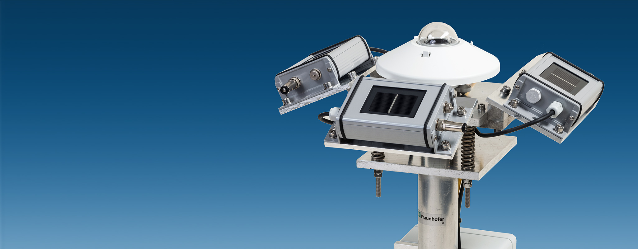
High Resolution Measurement Network of Global Horizontal and Tilted Solar Irradiance in Southern Germany with a New Quality Control Scheme
Lorenz, Elke; Guthke, Philipp; Dittmann, Anna; Holland, Nicolas; Herzberg, Wiebke; Karalus, Steffen; Müller, Björn; Braun, Christian; Heydenreich, Wolfgang; Saint-Drenan, Yves-Marie |
Zeitschriftenaufsatz
Journal Article
|
| 2022 |
Nutzung maschinellen Lernens und eines Strahlungsmessnetzes zur flächigen Strahlungsvorhersage aus Wolkenkamerabildern
Straub, Nils; Dittmann, Anna; Holland, Nicolas; Lorenz, Elke |
Konferenzbeitrag
Conference Paper
|
| 2022 |
The Influence of Different Degradation Characteristics on the Greenhouse Gas Emissions of Silicon Photovoltaics: A Threefold Analysis
Herceg, Sina; Kaaya, Ismail; Ascencio-Vásquez, Julián; Fischer, Marie; Weiß, Karl-Anders; Schebek, Liselotte |
Zeitschriftenaufsatz
Journal Article
|
| 2022 |
Nutzung maschinellen Lernens und eines Strahlungsmessnetzes zur flächigen Strahlungsvorhersage aus Wolkenkamerabildern
Straub, Nils |
Vortrag
Presentation
|
| 2022 |
Improved Blending of PV Power Forecasts in Case of Measurements with Limited Reliability
Herzberg, Wiebke; Holland, Nicolas; Zech, Tobias; Bor, Jefferson; Lorenz, Elke |
Vortrag
Presentation
|
| 2021 |
Modelling PV Self-consumption at Portfolio Level
Karalus, Steffen; Köpfer, Benedikt; Guthke, Philipp; Killinger, Sven; Lorenz, Elke |
Konferenzbeitrag
Conference Paper
|
| 2021 |
Modelling PV self-consumption at portfolio level
Karalus, Steffen; Köpfer, Benedikt; Guthke, Philipp; Killinger, Sven; Lorenz, Elke |
Konferenzbeitrag
Conference Paper
|
| 2021 |
A new sky imager based global irradiance forecasting model with analyses of cirrus situations
Dittmann, Anna; Holland, Nicolas; Lorenz, Elke |
Zeitschriftenaufsatz
Journal Article
|
| 2021 |
Energy Yield Simulation of 3D Curved VIPV Modules
Neven-du Mont, Sebastian; Alharthi, Hashem; Kutter, Christoph; Neuhaus, Holger; Heinrich, Martin |
Konferenzbeitrag
Conference Paper
|
| 2021 |
Referenzzellen vs. Pyranometer - Abweichungen und Umrechnung von Messwerten
Rivera Aguilar, Mariella Josefina; Reise, Christian |
Konferenzbeitrag
Conference Paper
|
| 2020 |
Ecological Synergy Effects of Agrivoltaic Systems
Keinath, Tobias; Högy, Petra; Trommsdorff, Maximilian; Went, Joachim |
Vortrag
Presentation
|
| 2020 |
PV Eigenverbrauch: Hochaufgelöste Modellierung von PV-Erzeugung und Verbrauch für verbesserte Einspeiseprognosen
Karalus, Steffen; Reise, Christian; Zech, Tobias; Holland, Nicolas; Herzberg, Wiebke; AlSayegh, Ghanem; Killinger, Sven; Lorenz, Elke; Guthke, Philipp |
Konferenzbeitrag
Conference Paper
|
| 2020 |
Minute Resolution Measurement Network for Global Horizontal and Tilted Solar Irradiance for a Transmission System Control Area in Southern Germany
Lorenz, Elke; Holland, Nicolas; Dittmann, Anna; Herzberg, Wiebke; Karalus, Steffen; Heydenreich, W.; Braun, Christian; Guthke, P.; Semmig, A. |
Konferenzbeitrag
Conference Paper
|
| 2020 |
Zukünftige Netzintegration von PV-Eigenverbrauch
Karalus, Steffen; Reise, Christian; Zech, Tobias; Holland, Nicolas; Herzberg, Wiebke; AlSayegh, Ghanem; Killinger, Sven; Guthke, Philipp; Lorenz, Elke |
Vortrag
Presentation
|
| 2020 |
GIS-basierte Potenzialanalyse für Agrophotovoltaik - Eine Fallstudie für die Region Bodensee-Oberschwaben
Hauger, Salome; Schindele, Stephan; Winkelhausen, Harald; Gimbel, Edgar; Wolf, Maritta; Jung, Martina; Beuerle, Rainer |
Poster
|
| 2020 |
Verification of deterministic solar forecasts
Yang, D.; Alessandrini, S.; Antonanzas, J.; Antonanzas-Torres, F.; Badescu, V.; Beyer, H.G.; Blaga, R.; Boland, J.; Bright, Jamie M.; Coimbra, C.F.M.; David, M.; Frimane, A.; Gueymard, C.A.; Hong, T.; Kay, M.J.; Killinger, Sven; Kleissl, J.; Lauret, P.; Lorenz, Elke; van der Meer, D.; Paulescu, M.; Perez, R.; Perpiñán-Lamigueiro, O.; Peters, I.M.; Reikard, G.; Renné, D.; Saint-Drenan, Yves-Marie; Shuai, Y.; Urraca, R.; Verbois, H.; Vignola, F.; Voyant, C.; Zhang, J. |
Zeitschriftenaufsatz
Journal Article
|
| 2020 |
Systemmodellierung und Simulation zur Optimierung der PV-Speisung von Wärmepumpen durch Kurzfristprognosen mit Wolkenkameras
Dittmann, Anna; Villegas Mier, Oscar; Ruf, Holger; Kober, Patrick; Lorenz, Elke; Schmidt, Michael |
Konferenzbeitrag
Conference Paper
|
| 2019 |
40 Jahre nach dem "Atlas über die Sonnenstrahlung in Europa". Umfang und Qualität Heutiger Einstrahlungsdatensätze
Reise, Christian; Lorenz, Elke; Müller, B. |
Konferenzbeitrag
Conference Paper
|
| 2019 |
PV-Live. Auswertung satellitenbasierter und gemessener Solarstrahlungsdaten für PV-Hochrechnungen
Lorenz, Elke; Heydenreich, W.; Braun, Christian; Holland, Nicolas; Xu-Sigurdsson, Bin; Zech, Tobias; Dittmann, Anna; Karalus, Steffen; Guthke, P. |
Konferenzbeitrag
Conference Paper
|
| 2019 |
Optimierung der PV-Speisung von Wärmepumpen durch Kurzfristprognosen mit Wolkenkameras
Dittmann, Anna; Kober, P.; Lorenz, Elke; Villegas Mier, O.; Ruf, H.; Schad, P.; Schmidt, M. |
Konferenzbeitrag
Conference Paper
|
| 2019 |
Energy yield analysis of textured perovskite silicon tandem solar cells and modules
Tucher, Nico; Höhn, Oliver; Narasimha Murthy, Jayanth; Martínez Sánchez, Juan Francisco; Steiner, Marc; Armbruster, Alfons; Lorenz, Elke; Bläsi, Benedikt; Goldschmidt, Jan Christoph |
Zeitschriftenaufsatz
Journal Article
|
| 2017 |
Angle dependence of solar cells and modules: The role of cell texturization
Geisemeyer, Ino; Tucher, Nico; Müller, B.; Steinkemper, Heiko; Hohl-Ebinger, Jochen; Schubert, Martin C.; Warta, Wilhelm |
Zeitschriftenaufsatz
Journal Article
|
 Fraunhofer Institute for Solar Energy Systems ISE